Terrain Setting Train
The Terrain Setting Train tool is a quick method to set or modify the terrain along the line of a railway (or road or river).
Open the terrain setting tool from the scenery menu:
The Terrain Setting Tool creates terrain points as the followed train runs along the track.
To set Terrain points along the track
- Select train to follow.
- Open the terrain setting tool
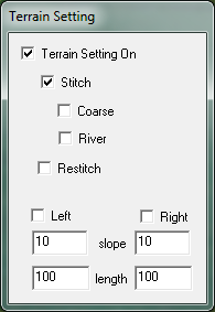
- Tick "Terrain Setting on"
- Tick "Stitch"
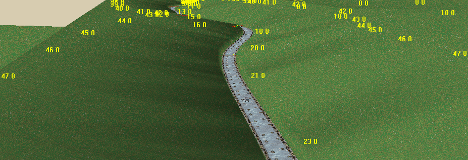
as the train moves along the track, it creates terrain points at the track elevation:
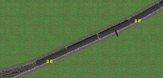
- points are created approximatly every 50 metres.
- The operation is similar to the Stitch Terrain To Track command, or using S Key Stitching
Note that the points are added to the terrain set, but the terrain surface will not be modifed until a terrain generate operation is performed.
Terrain setting options
There are two sub-options with terrain setting:
- "Coarse" spaces the generated points further apart to give a rougher terrain surface.
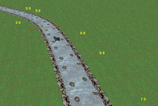
- "River" generates points to the side of the track and slightly higher than the track level - this is suitable for a river bed. By running a vehicle (eg landrover) along a river line, terrain points are generated either side: this is a good way to generate reasonable artificial terrain - put down a river and some higher terrain points, then allow the river to "carve out a valley" by stitching along the line of the river:
Note that the points are added to the terrain set, but the terrain surface will not be modifed until a terrain generate operation is performed.
Restitch
Restitch is useful if the line of track (or river etc) is changed in elevation. The terrain setting tool can be used to adjust the height of previously stitched points (restitch). Points along the line are adjusted to conform to the current elevation.
Note that the points are added to the terrain set, but the terrain surface will not be modifed until a terrain generate operation is performed.
Slope creation tools
The other function on the terrain setting tool is slope creation: the tool can be used to create a terrain surface to either side of the track.
There are two values for Left of the track and two for the right:
- slope specifes the angle of the slope in degrees
- length specified the distance from the track the points should be created
For example:
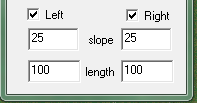
will create a valley 200 metres across with steep (25 degree) sides.
Note that the points are added to the terrain set, but the terrain surface will not be modifed until a terrain generate operation is performed.
MRG 23/08/2013 17:59:50